
Read your radio environment.
Collect Wi-Fi observations and Bluetooth LE advertisements with public macOS APIs. Compare RSSI, filter by radio and name, and keep a watchlist of signals that matter to your survey.
SignalAtlas · Wireless field observatory
Record Wi-Fi and Bluetooth observations. Compare signal strength. Revisit the places where your receiver saw them, with a survey history that stays on your Mac.
$4.99 US launch price · macOS 14+ · Apple silicon + Intel
Mac 1.0.0 (10) — Submitted · waiting for Apple review. Not yet available to download.
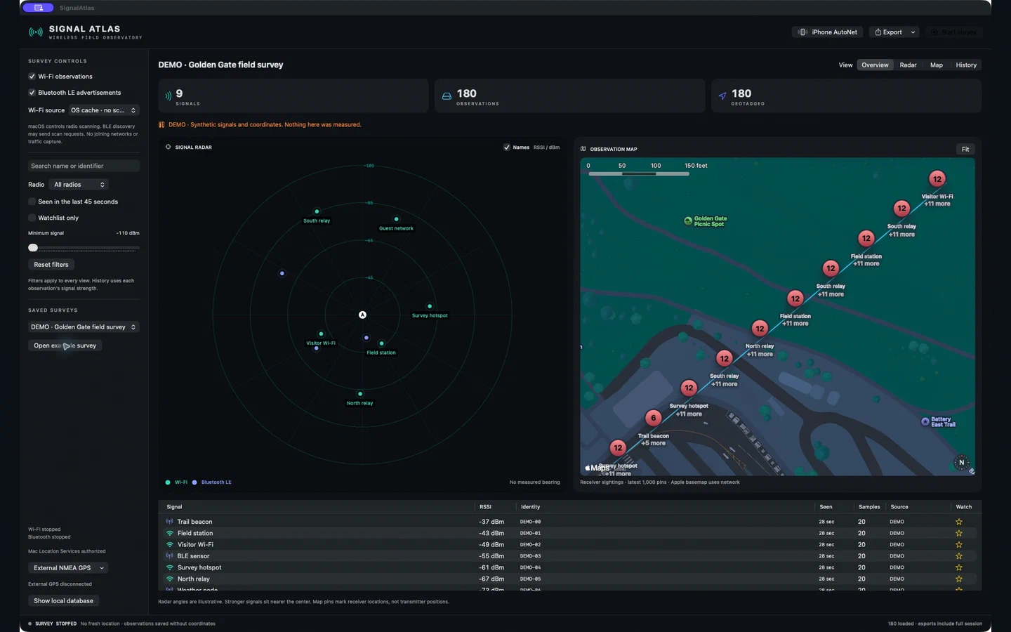
Collect Wi-Fi observations and Bluetooth LE advertisements with public macOS APIs. Compare RSSI, filter by radio and name, and keep a watchlist of signals that matter to your survey.
Switch between Overview, Radar, Map and History. Map pins show the receiver's location. Radar angles are illustrative; signal strength is not a distance measurement.
Save sessions locally and export their full observations as JSON, CSV or GeoJSON. Inspect the latest sample for each signal or every loaded observation. No account or subscription.
SignalAtlas GPS · Free companion
Pair an iPhone or iPad with your Mac using a QR code or pairing code. Keep the companion open beside the Mac to share fresh receiver-location fixes over your local network.
The Mac runs the wireless survey. The companion shares location only. You can also use Mac Location Services or a compatible NMEA receiver.
Requires: iOS or iPadOS 17+, the separately purchased Mac app, and the same local network. A Wi-Fi-only iPad may provide network-derived location.
GPS 1.0.0 (10) — Submitted · waiting for Apple review. Not yet available to download.
First launch, permissions, survey controls, map and radar interpretation, GPS pairing, NMEA, exports and troubleshooting.
Download the PDF manual ↓Read the accessible HTML edition →
Version 1.0 · Also available from the Mac app's Help menu.
Release 1.0 highlights
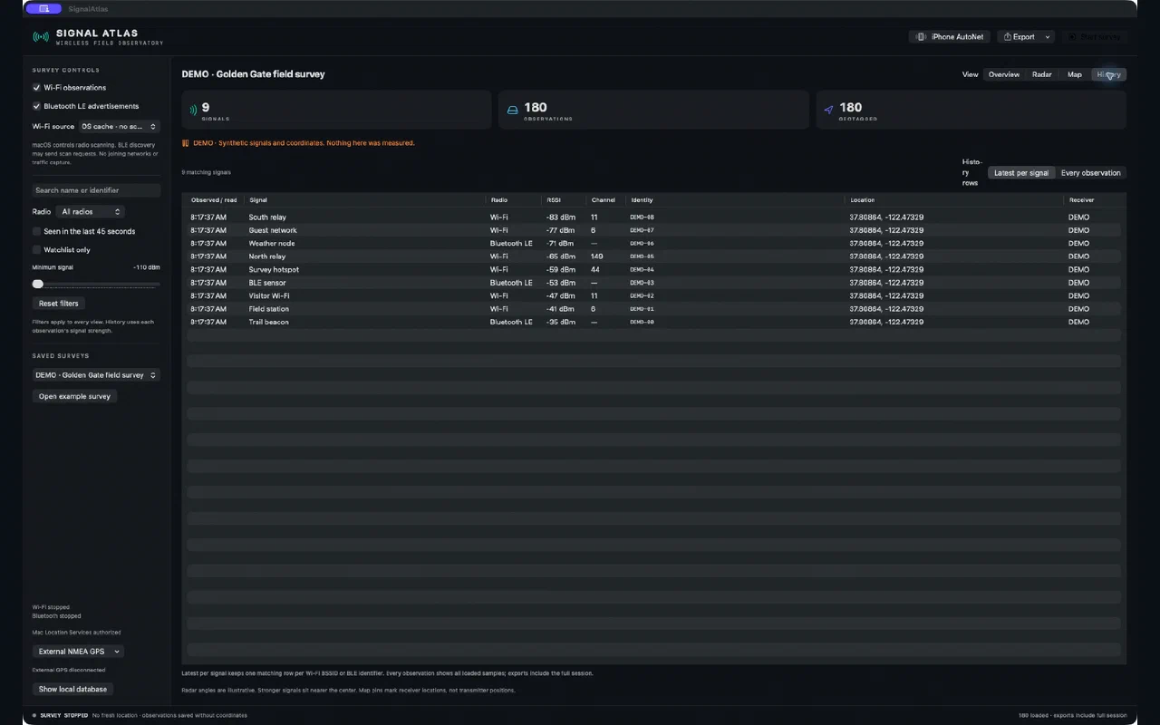
macOS controls radio scanning and may withhold Wi-Fi names or identifiers. SignalAtlas does not join networks or capture their traffic. Missing or stale location fixes are kept distinct from valid receiver positions.
For help, read the manual and troubleshooting guide or contact Orbitus Robotics. Include your app version, macOS or iOS version, and the steps that caused the issue. Keep pairing secrets and private survey data out of support messages.
No developer telemetry, advertising or tracking. Apple basemap services use the network. Read the SignalAtlas privacy policy.
Explore all Orbitus products →